Your feedback ensures we stay focused on the facts that matter to you most—take our survey.
File:Alabama Congressional 2023 map vs. 2022 map.png
From Ballotpedia
Size of this preview: 800 × 565 pixels. Other resolution: 1,700 × 1,200 pixels.
Original file (1,700 × 1,200 pixels, file size: 439 KB, MIME type: image/png)
Summary
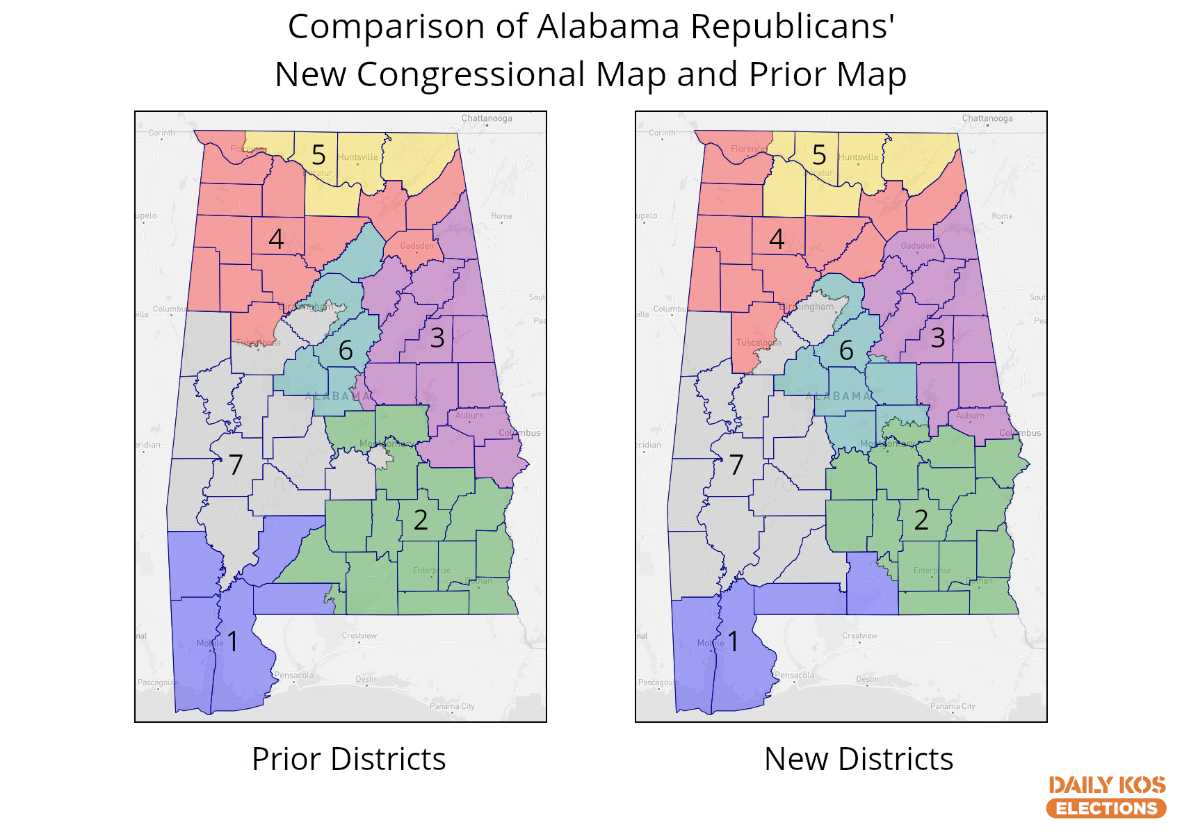
This image displays Alabama's congressional boundaries as enacted in 2021 versus those the state adopted in a 2023 special session.
Image from DK Elections: 
File history
Click on a date/time to view the file as it appeared at that time.
| Date/Time | Thumbnail | Dimensions | User | Comment | |
|---|---|---|---|---|---|
| current | 22:03, 25 July 2023 | | 1,700 × 1,200 (439 KB) | Dave Beaudoin (contribs) | This image displays Alabama's congressional boundaries as enacted in 2021 versus those the state adopted in a 2023 special session. Image from DK Elections: https://images.dailykos.com/images/1210688/original/AlabamaCongressionalMap-Republican2023mapvs.2022map.png |
You cannot overwrite this file.
File usage
The following page uses this file: