Become part of the movement for unbiased, accessible election information. Donate today.
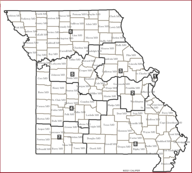
File:Missouri First Map png.png
From Ballotpedia
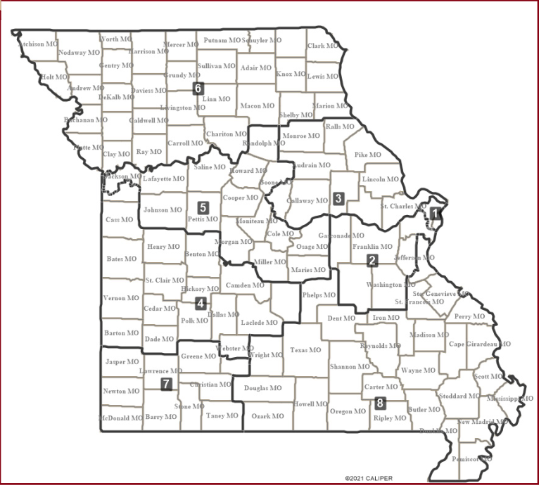
Size of this preview: 666 × 600 pixels. Other resolution: 766 × 690 pixels.
Original file (766 × 690 pixels, file size: 351 KB, MIME type: image/png)
File history
Click on a date/time to view the file as it appeared at that time.
| Date/Time | Thumbnail | Dimensions | User | Comment | |
|---|---|---|---|---|---|
| current | 03:52, 26 September 2025 | | 766 × 690 (351 KB) | Nathan Maxwell (contribs) |
You cannot overwrite this file.
File usage
The following 13 pages use this file:
- Congressional district maps implemented after the 2020 census
- Missouri's 1st Congressional District
- Missouri's 2nd Congressional District
- Missouri's 3rd Congressional District
- Missouri's 4th Congressional District
- Missouri's 5th Congressional District
- Missouri's 6th Congressional District
- Missouri's 7th Congressional District
- Missouri's 8th Congressional District
- Redistricting in Missouri
- Redistricting in Missouri after the 2020 census
- Redistricting in Missouri ahead of the 2026 elections
- User:Nathan Maxwell/Sandbox3