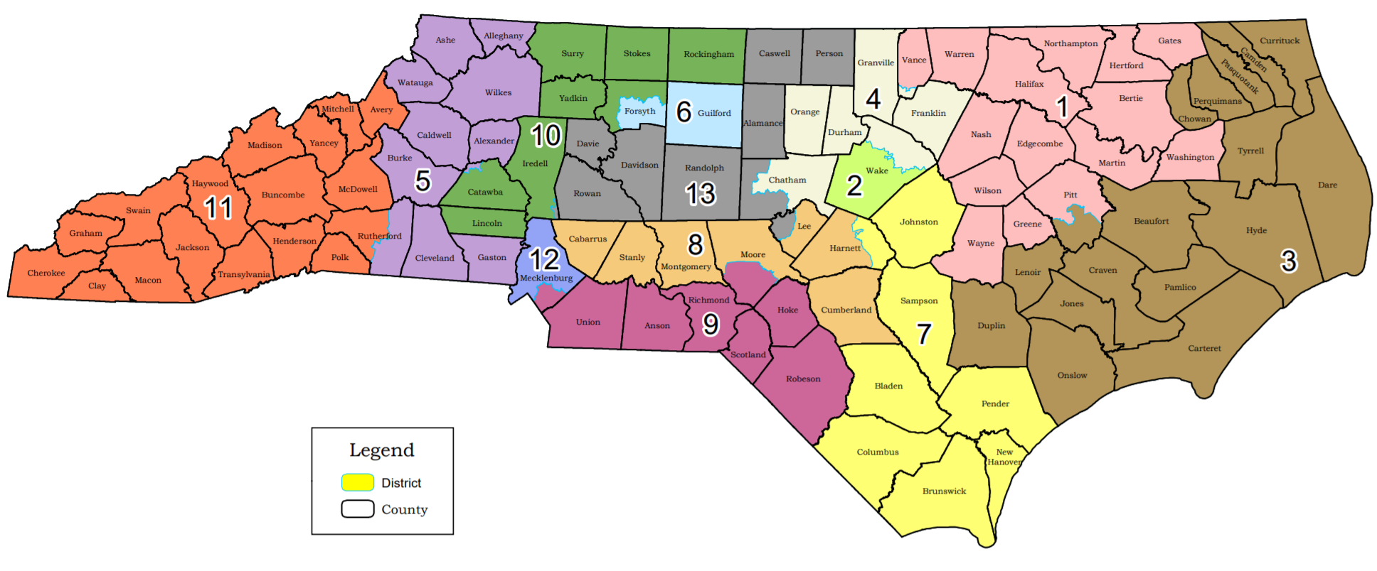
File:NC congressional district map 2019.png
From Ballotpedia
Size of this preview: 800 × 332 pixels. Other resolution: 1,936 × 804 pixels.
Original file (1,936 × 804 pixels, file size: 425 KB, MIME type: image/png)
This image comes from https://www.ncleg.gov/Files/GIS/Plans_Main/Congress_2019/HB1029%203rd%20Edition%20-%2011x17_Map.pdf and is in the public domain.
you can send your inquiry to editor@ballotpedia.org |
File history
Click on a date/time to view the file as it appeared at that time.
| Date/Time | Thumbnail | Dimensions | User | Comment | |
|---|---|---|---|---|---|
| current | 16:06, 24 August 2020 | | 1,936 × 804 (425 KB) | Daniel Anderson (contribs) | {{pd | link = https://www.ncleg.gov/Files/GIS/Plans_Main/Congress_2019/HB1029%203rd%20Edition%20-%2011x17_Map.pdf}} Category:Images of congressional districts, North Carolina |
You cannot overwrite this file.
File usage
There are no pages that use this file.