File:SBE Map.png
From Ballotpedia
No higher resolution available.
SBE_Map.png (462 × 393 pixels, file size: 48 KB, MIME type: image/png)
File history
Click on a date/time to view the file as it appeared at that time.
| Date/Time | Thumbnail | Dimensions | User | Comment | |
|---|---|---|---|---|---|
| current | 15:49, 29 October 2013 | | 462 × 393 (48 KB) | Nick Katers (contribs) | |
| 17:23, 25 October 2013 |  | 462 × 393 (48 KB) | Nick Katers (contribs) | ||
| 20:11, 15 October 2013 |  | 462 × 393 (48 KB) | Nick Katers (contribs) | ||
| 20:09, 15 October 2013 |  | 462 × 393 (48 KB) | Nick Katers (contribs) | ||
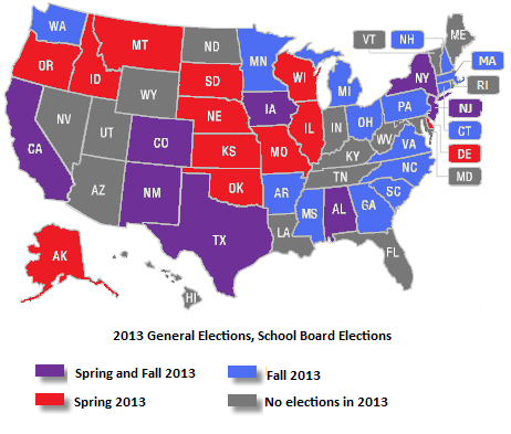
| 21:03, 24 July 2013 |  | 462 × 393 (48 KB) | Nick Katers (contribs) | Map of 2013 elections for school districts in the United States. Category:School board elections project | |
| 20:10, 24 July 2013 | 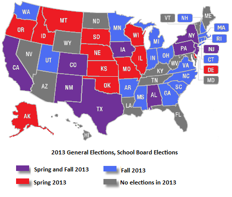 | 462 × 393 (48 KB) | Nick Katers (contribs) | Map of 2013 school board elections for main project portal. Category:School board elections project | |
| 19:41, 23 July 2013 | 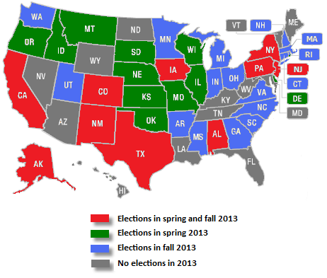 | 462 × 393 (48 KB) | Nick Katers (contribs) | School Board elections portal map for 2013. |
You cannot overwrite this file.
File usage
The following page uses this file: