Help us improve in just 2 minutes—share your thoughts in our reader survey.
File:Texas Congressional Redistricting Map.png
From Ballotpedia

Size of this preview: 800 × 513 pixels. Other resolution: 1,109 × 711 pixels.
Original file (1,109 × 711 pixels, file size: 346 KB, MIME type: image/png)
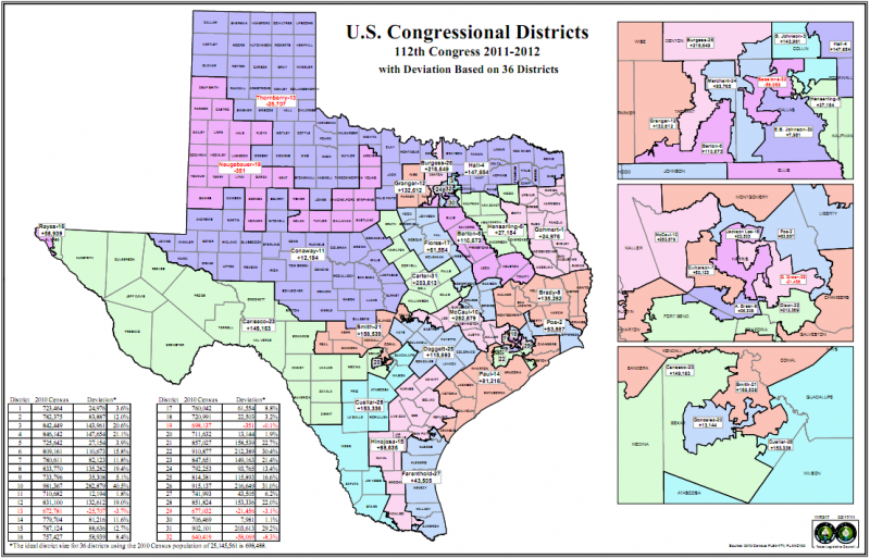
This redistricting map is public information produced by the Texas Legislative Council from the following link: http://www.tlc.state.tx.us/redist/pdf/census_2010/Congress_2010_Deviations.pdf
and is believed to be in the public domain.
This image comes from http://www.tlc.state.tx.us/doc_dist.htm and is in the public domain.
you can send your inquiry to editor@ballotpedia.org |
File history
Click on a date/time to view the file as it appeared at that time.
| Date/Time | Thumbnail | Dimensions | User | Comment | |
|---|---|---|---|---|---|
| current | 05:02, 3 June 2011 | | 1,109 × 711 (346 KB) | Jardis (contribs) | This redistricting map is public information produced by the Texas Legislative Council from the following link: http://www.tlc.state.tx.us/redist/pdf/census_2010/Congress_2010_Deviations.pdf and is believed to be in the public domain. {{pd | link = htt |
You cannot overwrite this file.
File usage
The following page uses this file: