File:US Map-partisanswing.PNG
From Ballotpedia
No higher resolution available.
US_Map-partisanswing.PNG (620 × 309 pixels, file size: 39 KB, MIME type: image/png)
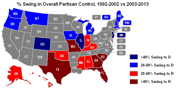
Map showing the states that experienced the greatest percentage partisan swing between the first and second half of the study
you can send your inquiry to editor@ballotpedia.org |
File history
Click on a date/time to view the file as it appeared at that time.
| Date/Time | Thumbnail | Dimensions | User | Comment | |
|---|---|---|---|---|---|
| current | 06:14, 21 May 2013 | | 620 × 309 (39 KB) | Andymarshall (contribs) | Map showing the states that experienced the greatest percentage partisan swing between the first and second half of the study |
You cannot overwrite this file.
File usage
The following page uses this file: