File:US Map-presidentialelections.png
From Ballotpedia
No higher resolution available.
US_Map-presidentialelections.png (644 × 309 pixels, file size: 40 KB, MIME type: image/png)
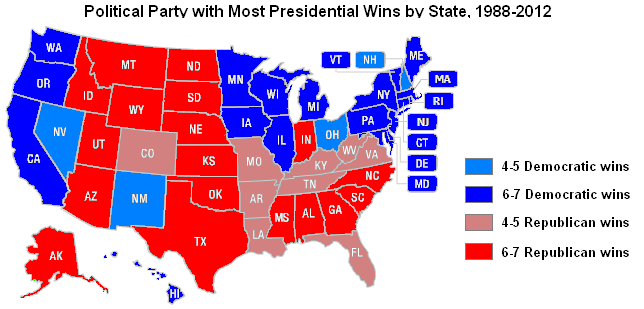
Map showing presidential voting over the past seven elections
you can send your inquiry to editor@ballotpedia.org |
File history
Click on a date/time to view the file as it appeared at that time.
| Date/Time | Thumbnail | Dimensions | User | Comment | |
|---|---|---|---|---|---|
| current | 06:39, 21 May 2013 | | 644 × 309 (40 KB) | Andymarshall (contribs) | Map showing presidential voting over the past seven elections Category:Who runs the states project, images {{BP logo}} |
You cannot overwrite this file.
File usage
The following page uses this file: