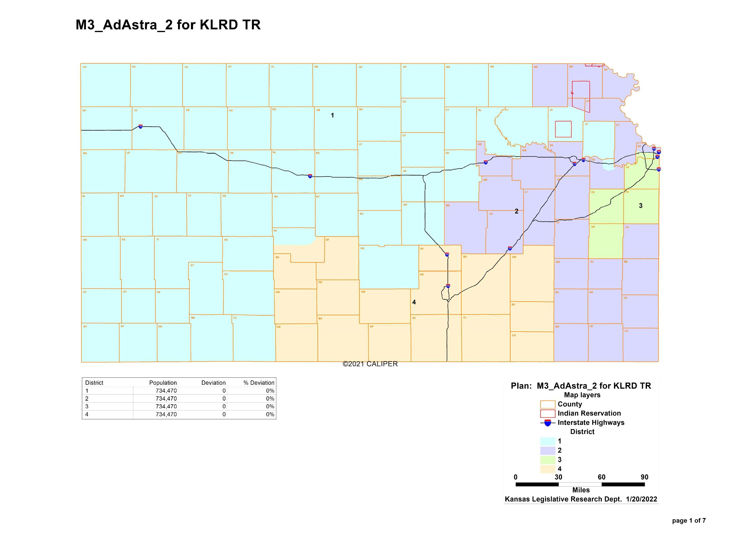
File:Kansas congressional map Feb 9 2022.png
From Ballotpedia
Size of this preview: 800 × 574 pixels. Other resolution: 2,465 × 1,769 pixels.
Original file (2,465 × 1,769 pixels, file size: 1,022 KB, MIME type: image/png)
Summary
you can send your inquiry to editor@ballotpedia.org |
File history
Click on a date/time to view the file as it appeared at that time.
| Date/Time | Thumbnail | Dimensions | User | Comment | |
|---|---|---|---|---|---|
| current | 22:07, 15 February 2022 | | 2,465 × 1,769 (1,022 KB) | Dave Beaudoin (contribs) | {{State document | link = http://www.kslegislature.org/li/b2021_22/measures/ds_maps/map_b_adastra2_2787.pdf}} Category: Redistricting images |
You cannot overwrite this file.
File usage
There are no pages that use this file.