Become part of the movement for unbiased, accessible election information. Donate today.
File:MS State House 2010 Census Map.png
From Ballotpedia
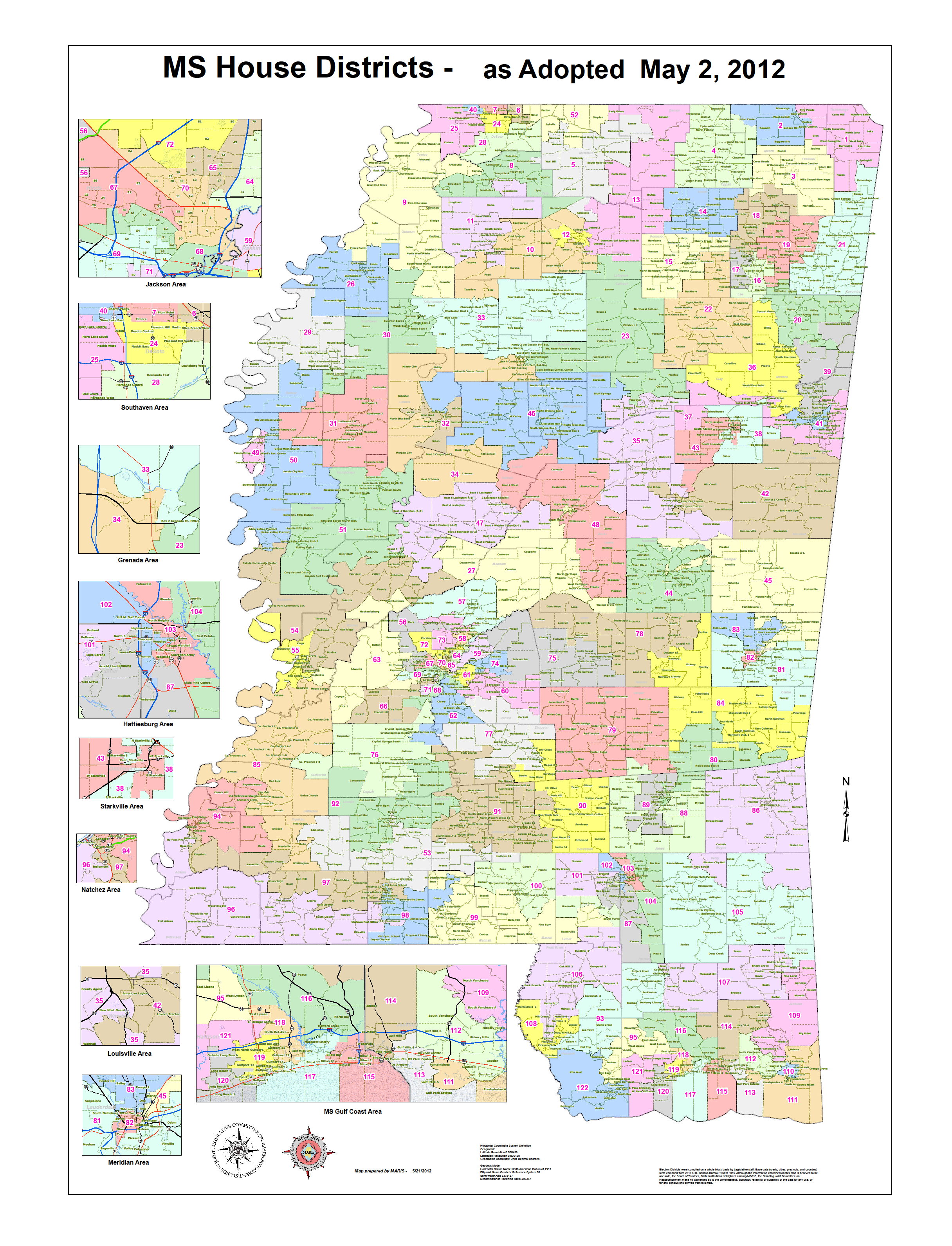
Size of this preview: 458 × 600 pixels. Other resolution: 2,432 × 3,184 pixels.
Original file (2,432 × 3,184 pixels, file size: 3.96 MB, MIME type: image/png)
you can send your inquiry to editor@ballotpedia.org |
File history
Click on a date/time to view the file as it appeared at that time.
| Date/Time | Thumbnail | Dimensions | User | Comment | |
|---|---|---|---|---|---|
| current | 17:18, 25 July 2012 | | 2,432 × 3,184 (3.96 MB) | PSletten (contribs) | {{state document | link = http://www.maris.state.ms.us/pdf/MS2010HouseDist/House_May2_2012.pdf }} Category:State legislative redistricting maps, 2011 |
| 17:17, 25 July 2012 | Error creating thumbnail: File missing | 2,432 × 3,184 (3.96 MB) | PSletten (contribs) | {{state document | link = http://www.maris.state.ms.us/pdf/MS2010HouseDist/House_May2_2012.pdf }} Category:State legislative redistricting maps, 2011 | |
| 16:48, 25 July 2012 | Error creating thumbnail: File missing | 1,417 × 2,313 (1.01 MB) | PSletten (contribs) | {{state document | link = http://www.msjrc.state.ms.us/pdf/house_plan_map.pdf }} Category:State legislative redistricting maps, 2011 |
You cannot overwrite this file.
File usage
The following page uses this file: