Category:State legislative district maps drawn after the 2010 census
From Ballotpedia
Media in category "State legislative district maps drawn after the 2010 census"
The following 200 files are in this category, out of 282 total.
(previous page) (next page)- AFFR proposed redistricting plan.png 800 × 589; 109 KB
- AK State Legislative 2010 Census Map.jpg 1,006 × 792; 137 KB
- AK State Senate 2010 Census Map (interim 2012).jpg 2,397 × 1,731; 500 KB
- AL State House 2010 Census Map.png 612 × 792; 929 KB
- AlaskaCurrent.jpg 3,399 × 2,626; 758 KB
- AlaskaOption1.jpg 3,399 × 2,199; 867 KB
- AlaskaOption2.jpg 3,399 × 2,199; 874 KB
- AR Senate Proposed Beebe.jpg 1,280 × 886; 257 KB
- AR State Senate 2010 Census Map.jpg 1,424 × 675; 256 KB
- Arkansas House Redistricting Map 2010.png 1,056 × 729; 391 KB
- AZ Legislative Option 1.jpg 769 × 1,007; 60 KB
- AZ Legislative Option 2.jpg 769 × 1,007; 56 KB
- AZ State legislative December 2011.jpg 4,949 × 6,450; 4.41 MB
- AZ State legislative draft October 2011.jpg 6,450 × 4,949; 8.89 MB
- AZ State Senate 2010 Census Map.jpg 2,592 × 3,168; 1.69 MB
- CA Assembly Map 2011.png 610 × 777; 79 KB
- CA Senate Map 2011.png 612 × 792; 73 KB
- CA State Assembly 2010 Census Map.jpg 632 × 792; 137 KB
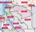
- CA State Senate 2010 Census Map.jpg 1,510 × 1,958; 451 KB
- Central-Coast3 Assembly Draft.jpg 858 × 689; 86 KB
- Central-Coast4 Senate Draft.jpg 935 × 740; 111 KB
- CO State House 2010 Census Map.jpg 793 × 614; 167 KB
- CO State Senate 2010 Census Map.png 801 × 613; 165 KB
- CT State House 2010 Census Map.jpg 3,456 × 2,592; 1.14 MB
- CT State Senate 2010 Census Map.png 3,456 × 2,592; 505 KB
- DE Minority Caucus House Map.JPG 450 × 637; 153 KB
- DE State House 2010 Kent Census Map.png 793 × 608; 324 KB
- DE State House 2010 NewCastle Census Map.png 680 × 860; 184 KB
- DE State House 2010 Sussex Census Map.png 632 × 793; 437 KB
- East-Bay1 Assembly Draft.jpg 791 × 694; 123 KB
- East-Bay2 Senate Draft.jpg 935 × 740; 127 KB
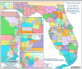
- Florida 2012 House Redistricting Map.png 717 × 603; 338 KB
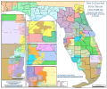
- Florida 2012 Senate Redistricting Map.png 719 × 600; 321 KB
- GA State House 2010 Census Map.jpg 622 × 793; 157 KB
- GA State Senate 2010 Census Map.png 640 × 794; 104 KB
- GeorgiaHousePlan.jpg 994 × 1,287; 243 KB
- GeorgiaSenatePlan.jpg 994 × 1,287; 215 KB
- HI State Legislature Hawaii 2010 Census Map.png 3,456 × 2,592; 601 KB
- HI State Legislature Kauai 2010 Census Map.png 3,456 × 2,592; 516 KB
- HI State Legislature Maui 2010 Census Map.png 3,456 × 2,592; 592 KB
- HI State Legislature Oahu 2010 Census Map.png 3,456 × 2,600; 796 KB
- IA State House 2010 Census Map.jpg 806 × 623; 166 KB
- IA StateSenate 2010 Map.png 792 × 601; 89 KB
- Idaho 2011 House Redistricting Map.png 494 × 657; 307 KB
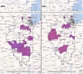
- IL State Legislature 2010 Census Map.png 620 × 792; 75 KB
- IL State Legislature Cook 2010 Census Map.png 625 × 794; 65 KB
- IL State Senate 2010 Census Map.jpg 612 × 792; 142 KB
- IN State House 2010 Census Map.png 860 × 1,147; 662 KB
- IN State Senate 2010 Census Map.png 860 × 1,147; 518 KB
- Inlad-Empire-Rural Senate Draft.jpg 938 × 755; 97 KB
- Inland-Empire-Rural Assembly Draft.jpg 791 × 694; 48 KB
- Inland-Empire-Urban1 Assembly Draft.jpg 791 × 694; 105 KB
- Inland-Empire-Urban2 Senate Draft.jpg 938 × 755; 126 KB
- IowaStatePlanScaled.jpg 5,100 × 3,300; 3.64 MB
- KS State House 2010 Census Map.jpg 858 × 663; 132 KB
- KS State Senate 2010 Census Map.png 792 × 612; 101 KB
- LA 2011 HB 1 Re-engrossed.jpg 819 × 612; 158 KB
- LA Senate 2011 maps.jpg 1,495 × 1,155; 261 KB
- LA State House 2010 Census Map.jpg 3,456 × 2,592; 1.03 MB
- LA State Senate 2010 Census Map.png 792 × 612; 83 KB
- LA-South-Bay Assembly Draft.jpg 791 × 694; 92 KB
- LA1 Assembly Draft.jpg 791 × 694; 92 KB
- Los-Angeles2 Senate Draft.jpg 938 × 755; 150 KB
- Louisiana House Draft Map 1B.jpg 819 × 612; 148 KB
- MA State House 2010 Census Map.jpg 4,500 × 3,352; 1.52 MB
- MA State Senate 2010 Census Map.jpg 4,500 × 3,353; 1.79 MB
- MA-State House Fair Districts Mass 2011.jpg 1,224 × 792; 313 KB
- MA-State Senate Fair Districts Mass 2011.jpg 1,224 × 792; 321 KB
- MD State House 2010 Census Map.jpg 2,592 × 1,728; 740 KB
- MD State Senate 2010 Census Map.jpg 2,592 × 1,728; 700 KB
- MI State House 2010 Census Map.jpg 2,448 × 3,168; 2.55 MB
- MI State Senate 2010 Census Map.jpg 3,722 × 4,826; 4.2 MB
- MIProposedCongressionalPlan.jpg 1,999 × 1,499; 243 KB
- MIProposedHousePlan.jpg 1,999 × 1,499; 254 KB
- MIProposedSenatePlan.jpg 2,000 × 1,500; 243 KB
- MIProposedSenatePlanArea.jpg 1,999 × 1,499; 237 KB
- MISenateAmended.jpg 1,999 × 1,499; 235 KB
- MN State House 2010 Census Map.jpg 623 × 793; 118 KB
- MN State Senate 2010 Census Map.jpg 932 × 1,213; 193 KB
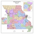
- MO State House 2010 Census Map.png 2,592 × 1,728; 856 KB
- MO State Senate 2010 Census Map.jpg 2,304 × 2,304; 1.41 MB
- MS House Proposal 2011.JPG 3,888 × 5,185; 2.58 MB
- MS Senate Proposal 2011.JPG 3,888 × 5,185; 2.49 MB
- MS State House 2010 Census Map.png 2,432 × 3,184; 3.96 MB
- NC House map adopted 8-30-17.png 1,569 × 702; 422 KB
- NC Senate map adopted 8-30-17.png 1,574 × 706; 365 KB
- NC StateHouse 2010 Map.jpg 1,224 × 792; 259 KB
- NCHouseFull.jpg 1,699 × 1,099; 243 KB
- NCHouseFull2.jpg 2,311 × 1,495; 364 KB
- NCHouseFullFinal.jpg 2,311 × 1,495; 365 KB
- NCHouseVRA.jpg 1,989 × 1,287; 316 KB
- NCSenateFinal.jpg 2,311 × 1,495; 304 KB
- NCSenateFull.jpg 1,699 × 1,099; 197 KB
- NCSenateVRA.jpg 1,989 × 1,287; 280 KB
- ND State Legislature 2010 Census Map.jpg 925 × 563; 336 KB
- Error creating thumbnail: File with dimensions greater than 12.5 MPNE State Legislative 2010 Census Map.png 5,100 × 3,300; 529 KB
- NE State Legislature 2010 Census Map.png 1,244 × 804; 81 KB


