Become part of the movement for unbiased, accessible election information. Donate today.
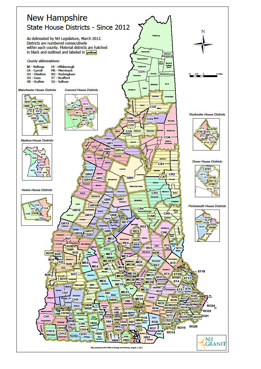
File:NH State House Map 2010 Census.png
From Ballotpedia
Size of this preview: 423 × 599 pixels. Other resolution: 842 × 1,192 pixels.
Original file (842 × 1,192 pixels, file size: 254 KB, MIME type: image/png)
you can send your inquiry to editor@ballotpedia.org |
Note: This document was supplied to Ballotpedia via email by the New Hampshire Office of Energy & Planning.
File history
Click on a date/time to view the file as it appeared at that time.
| Date/Time | Thumbnail | Dimensions | User | Comment | |
|---|---|---|---|---|---|
| current | 05:04, 5 August 2012 | | 842 × 1,192 (254 KB) | PSletten (contribs) | {{state document | link = http://www.nh.gov/oep/programs/GIS/index.htm}} Note: This document was supplied to Ballotpedia via email by the New Hampshire Office of Energy & Planning. Category:State legislative redistricting maps, 2011 |
You cannot overwrite this file.
File usage
The following page uses this file: