Help us improve in just 2 minutes—share your thoughts in our reader survey.
File:US Map-singlepartyhouse.PNG
From Ballotpedia
No higher resolution available.
US_Map-singlepartyhouse.PNG (563 × 338 pixels, file size: 37 KB, MIME type: image/png)
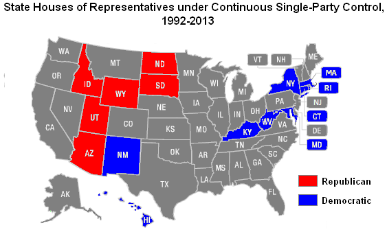
Map of state senates under single-party control from 1992-2013
you can send your inquiry to editor@ballotpedia.org |
File history
Click on a date/time to view the file as it appeared at that time.
| Date/Time | Thumbnail | Dimensions | User | Comment | |
|---|---|---|---|---|---|
| current | 05:34, 21 May 2013 | | 563 × 338 (37 KB) | Andymarshall (contribs) | Map of state senates under single-party control from 1992-2013 Category:Who runs the states project, images {{BP logo}} |
You cannot overwrite this file.
File usage
The following page uses this file: