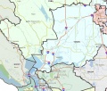
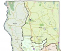
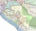
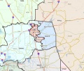
Category:Congressional district maps drawn after the 2010 census
From Ballotpedia
Media in category "Congressional district maps drawn after the 2010 census"
The following 163 files are in this category, out of 163 total.
- 2011 PA map.png 1,193 × 767; 1.09 MB
- Alabama Congressional map after 2010 Census.png 612 × 792; 878 KB
- April 2011 Iowa Redistricting Map.jpg 871 × 543; 97 KB
- AR Citizen Map 1.jpg 768 × 1,008; 89 KB
- AR Congressional Map 041111.jpg 799 × 579; 217 KB
- AR Senate Map 040511.jpg 600 × 449; 40 KB
- AR Senate Map Final 040511.jpg 600 × 449; 37 KB
- Arizona's 8th Congressional District Before and After the 2010 Census Redistricting.jpg 2,600 × 1,002; 337 KB
- Arizona's 9th Congressional District Before and After the 2010 Census Redistricting.jpg 2,704 × 1,014; 355 KB
- AZ congressional December 2011.jpg 4,949 × 6,450; 3.66 MB
- AZ Congressional Draft October 2011.jpg 6,450 × 4,949; 4.13 MB
- AZ Congressional Option 1.jpg 769 × 1,007; 48 KB
- AZ Congressional Option 2.jpg 769 × 1,007; 47 KB
- BalmerMap1.jpg 550 × 407; 86 KB
- CA Citizen Map 1.JPG 960 × 792; 70 KB
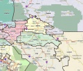
- CA Congressional East San Fernando June1.jpg 1,320 × 945; 285 KB
- CA Congressional LA Beach June1.jpg 1,320 × 945; 395 KB
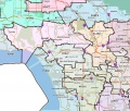
- CA Congressional LA June1.jpg 1,320 × 945; 243 KB
- CA Congressional Map 2011.png 612 × 792; 75 KB
- CA Congressional North June1.jpg 1,320 × 945; 315 KB
- CA Congressional Sacremento June1.jpg 1,320 × 945; 369 KB
- CA Congressional San Fernando June1.jpg 1,320 × 945; 313 KB
- CA Congressional San Gabriel June1.jpg 1,320 × 945; 412 KB
- CA Congressional SFBay June1.jpg 1,320 × 945; 404 KB
- Central-Central-Valley draft.jpg 1,061 × 906; 165 KB
- Central-Coast draft.jpg 1,061 × 906; 162 KB
- CityIntegrity1.jpg 550 × 406; 58 KB
- CO 2011 Comparison Congressional Map.png 819 × 612; 132 KB
- East-CA draft.jpg 1,061 × 906; 139 KB
- Eastbay draft.jpg 1,061 × 906; 189 KB
- Fayetteville to the 4th New.jpg 632 × 474; 153 KB
- Fayetteville to the 4th.jpg 500 × 378; 79 KB
- February 2012 Connecticut Redistricting Map.jpg 580 × 420; 79 KB
- February 2012 Kentucky Redistricting Map.jpg 1,900 × 936; 186 KB
- GeorgiaCongPlan.jpg 994 × 1,287; 147 KB
- GeorgiaCongPlan2.jpg 994 × 1,287; 205 KB
- GOP Plan A.jpg 819 × 612; 136 KB
- Hawaii September 2011 Redistricting Map.jpg 823 × 540; 77 KB
- IL Congressional District 1 map, 2012-2020.jpg 1,275 × 1,650; 399 KB
- IL Congressional District 10 map, 2012-2020.jpg 1,275 × 1,650; 352 KB
- IL Congressional District 11 map, 2012-2020.jpg 1,275 × 1,650; 364 KB
- IL Congressional District 12 map, 2012-2020.jpg 1,275 × 1,650; 279 KB
- IL Congressional District 13 map, 2012-2020.jpg 1,275 × 1,650; 398 KB
- IL Congressional District 14 map, 2012-2020.jpg 1,275 × 1,650; 364 KB
- IL Congressional District 15 map, 2012-2020.jpg 1,275 × 1,650; 377 KB
- IL Congressional District 16 map, 2012-2020.jpg 1,275 × 1,650; 371 KB
- IL Congressional District 16 map, comparing pre and post 2011 redistricting.jpg 1,550 × 958; 218 KB
- IL Congressional District 17 map, 2012-2020.png 1,275 × 1,650; 499 KB
- IL Congressional District 18 map, 2012-2020.jpg 1,275 × 1,650; 372 KB
- IL Congressional District 2 map, 2012-2020.jpg 1,275 × 1,650; 281 KB
- IL Congressional District 3 map, 2012-2020.jpg 1,275 × 1,650; 423 KB
- IL Congressional District 4 map, 2012-2020.jpg 1,275 × 1,650; 335 KB
- IL Congressional District 5 map, 2012-2020.jpg 1,275 × 1,650; 373 KB
- IL Congressional District 6 map, 2012-2020.jpg 1,275 × 1,650; 425 KB
- IL Congressional District 7 map, 2012-2020.jpg 1,275 × 1,650; 349 KB
- IL Congressional District 8 map, 2012-2020.jpg 1,275 × 1,650; 389 KB
- IL Congressional District 9 map, 2012-2020.jpg 1,275 × 1,650; 345 KB
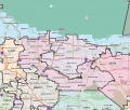
- Inland-Empire-Urban draft.jpg 1,061 × 906; 184 KB
- IowaCongPlanScaled.jpg 1,650 × 1,275; 228 KB
- June 2011 Illinois Redistricting Map.jpg 272 × 387; 53 KB
- Kansas Congressional Map 2012.jpg 792 × 612; 94 KB
- LA 2011 HB6 Re-engrossed.jpg 819 × 612; 109 KB
- LA draft.jpg 1,061 × 906; 206 KB
- MA Citizen Map 1.JPG 960 × 629; 72 KB
- MA-Cong Fair Districts Mass 2011 A.jpg 747 × 607; 133 KB
- MA-Cong Fair Districts Mass 2011 B.jpg 792 × 612; 133 KB
- Maine Congressional Map 2011.jpg 800 × 1,280; 372 KB
- Maine Congressional Map Options.jpg 600 × 400; 111 KB
- Maryland October 2011 Redistricting Map.png 839 × 497; 140 KB
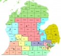
- Michigan August 2011 Redistricting Map.jpg 550 × 505; 72 KB
- Missouri HB193SSFullMap April 13 2011.jpg 1,260 × 960; 134 KB
- Missouri HCS193 April 11 2011.jpg 1,211 × 831; 114 KB
- NCCongProposed.jpg 2,311 × 1,495; 336 KB
- NCCongProposed2.jpg 2,311 × 1,495; 340 KB
- NCCongProposed2A.jpg 2,311 × 1,495; 340 KB
- NCCongressFinal.jpg 2,311 × 1,495; 340 KB
- New Hampshire Congress Map 2012.png 792 × 1,224; 211 KB
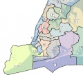
- New York Congress Map 2 2012.jpg 728 × 398; 78 KB
- New York Congress Map 2012.jpg 693 × 557; 82 KB
- New York Congress Map 3 2012.jpg 536 × 486; 76 KB
- New York's 7th Congressional District Before and After the 2010 Census Redistricting.jpg 2,399 × 1,018; 495 KB
- New York's 9th Congressional District Before and After the 2010 Census Redistricting.jpg 2,174 × 1,008; 394 KB
- New York's Congressional Districts Before and After the 2010 Census Redistricting.jpg 1,666 × 1,112; 806 KB
- NJ Congressional Districts 2012-2021.png 612 × 1,008; 169 KB
- North-SF-Bay1 draft.jpg 1,061 × 906; 168 KB
- North-State draft.jpg 1,061 × 906; 153 KB
- NV Congressional Draft October 2011.JPG 701 × 917; 86 KB
- OHDistrict2final2012.jpg 750 × 470; 87 KB
- OHdistrict9overlay.jpg 795 × 368; 67 KB
- Ohio Congressional DTLM.jpg 1,339 × 1,799; 538 KB
- Ohio Congressional Final.jpg 994 × 1,287; 216 KB
- Ohio Congressional Proposed.jpg 1,377 × 1,737; 609 KB
- OrangeCounty draft.jpg 1,061 × 906; 177 KB
- Remedial PA map.png 1,084 × 718; 527 KB
- Sacramento draft.jpg 1,061 × 906; 154 KB
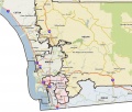
- San-Diego1 draft.jpg 1,061 × 906; 141 KB
- San-Fernando-Valley1 draft.jpg 1,061 × 906; 164 KB
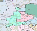
- San-Gabriel-Valley3 draft.jpg 1,061 × 906; 189 KB
- SC ACLU Congressional May 4.JPG 3,168 × 2,448; 539 KB
- SC Clyburn Congressional Citizen Map.JPG 3,168 × 2,448; 543 KB
- SC Congressional House Passed.JPG 506 × 411; 33 KB
- SC Congressional Proposed May 17.JPG 571 × 571; 33 KB
- SC Kuhn Congressional Citizen Map.JPG 3,168 × 2,448; 527 KB
- SC Mulvaney-Wilson Congressional May 9.JPG 3,168 × 2,448; 553 KB
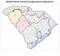
- SC NAACP Congressional.JPG 612 × 571; 40 KB
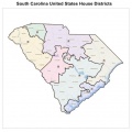
- SCCongressFinal.jpg 1,936 × 1,496; 430 KB
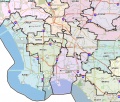
- South-Bay-LA draft.jpg 1,061 × 906; 204 KB
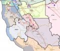
- South-SF-Bay draft.jpg 1,061 × 906; 160 KB
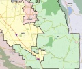
- Southern-Central-Valley draft.jpg 1,061 × 906; 130 KB
- Tennessee Congressional Proposed Map 2012.png 1,008 × 612; 54 KB


