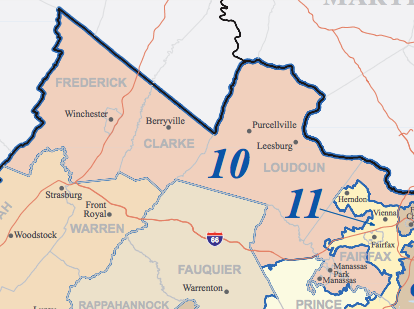
File:Virginia District 10 Map.PNG
From Ballotpedia
No higher resolution available.
Virginia_District_10_Map.PNG (414 × 309 pixels, file size: 86 KB, MIME type: image/png)
This image comes from https://www2.census.gov/geo/maps/cong_dist/cd115/st_based/CD115_VA.pdf and is in the public domain in the United States because it is a work of the United States Federal Government under the terms of Title 17, Chapter 1, Section 105 of the United States Code.
Note: This only applies to works of the Federal Government and not to the work of any individual state, territory, commonwealth, county, municipality, or any other subdivision. This template also does not apply to postage stamp designs published by the United States Postal Service since 1978. (See 206.02(b) of Compendium II: Copyright Office Practices).
you can send your inquiry to editor@ballotpedia.org |
File history
Click on a date/time to view the file as it appeared at that time.
| Date/Time | Thumbnail | Dimensions | User | Comment | |
|---|---|---|---|---|---|
| current | 20:07, 22 January 2018 | | 414 × 309 (86 KB) | Jerrick Adams (contribs) | |
| 17:27, 21 January 2014 | 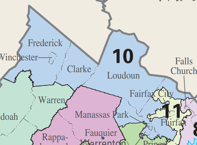 | 652 × 478 (117 KB) | Sarah Rosier (contribs) | ||
| 20:45, 4 November 2013 | 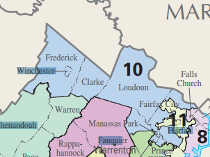 | 302 × 226 (41 KB) | Mbusse (contribs) | {{pd-fedgov | link =http://nationalatlas.gov/printable/images/pdf/congdist/pagecgd113_va.pdf}} Category:Images of congressional districts, Virginia |
You cannot overwrite this file.
File usage
There are no pages that use this file.